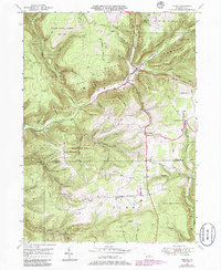
1946 Map of Morris
USGS Topo · Published 1986About this map
Babb Creek carves a deep valley through the high plateaus of northern Pennsylvania, serving as the central artery for settlements like Morris and Hoytville. This mid-century landscape reflects a region defined by its timber and mineral resources, evidenced by the expansive Tioga State Forest and several mines tucked into the northern hills. The terrain is marked by named ridges and peaks such as Tannery Hill, Hickory Ridge, and Texas Mountain, which divide the many smaller runs feeding into the main valley. Smaller hamlets like Lorenton, Doane, and Mt Pleasant dot the roads, while the Crawford Fire Tower stands on a high point in the southern reaches of State Game Lands No 75. The map also preserves the locations of local landmarks like Antrim Cem and Lewis Cem, offering a detailed view of the rural Tioga County community just after the war.
Find a feature on this map
54 named features on this map. Tap any name to fly to it.
Don’t see what you’re looking for? This feature index may not catch every label — zoom into the map to look around manually.
Map Details
Editions of this 1946 Morris Map
3 editions found

Other maps of this area

1921 · Trout Run
USGS Topo · 1:62,500

1923 · Trout Run
USGS Topo · 1:62,500

1925 · Blossburg
USGS Topo · 1:62,500

1927 · Blossburg
USGS Topo · 1:62,500

1937 · Waterville
USGS Topo · 1:48,000

1943 · Waterville
USGS Topo · 1:62,500

1944 · Blossburg
USGS Topo · 1:62,500

1944 · Trout Run
USGS Topo · 1:62,500

1946 · Tiadaghton
USGS Topo · 1:24,000

1946 · Antrim
USGS Topo · 1:62,500
Featured Places
- Morris Township, PA
- Duncan Township, PA
- Brown Township, PA
- Pine Township, PA
- Mount Pleasant, Morris Township