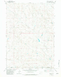
1982 Map of Morrisey
USGS Topo · Published 1982About this map
Morrisey anchors the southeastern corner of this high plains landscape, situated near the boundary between Weston and Niobrara counties. The drainage patterns here are complex, defined by several significant watercourses including Sheep Creek, Alkali Creek, and the evocatively named Robbers Roost Creek in the northeast. Land use in the late 1970s is evidenced by several industrial and agricultural markers, such as dispersed Drill Hole locations and water infrastructure like 3975 Tank. The terrain transitions into distinct geomorphological features in the south, notably Bum Draw and Whitney Draw, reflecting the arid and dissected nature of the Wyoming backcountry during this era.
Find a feature on this map
11 named features on this map. Tap any name to fly to it.
Don’t see what you’re looking for? This feature index may not catch every label — zoom into the map to look around manually.
Map Details
Editions of this 1982 Morrisey Map
This is the sole edition of this map. No revisions or reprints were ever made.
Other maps of this area

1899 · Newcastle
USGS Topo · 1:125,000

1901 · Newcastle
USGS Topo · 1:125,000

1951 · Morrisey NE
USGS Topo · 1:24,000

1955 · Newcastle
USGS Topo · 1:250,000

1958 · Newcastle
USGS Topo · 1:250,000

1979 · Newcastle
USGS Topo · 1:100,000

1981 · Horseshoe Bend
USGS Topo · 1:24,000

1981 · Threemile Butte
USGS Topo · 1:24,000
1981 · Little Alkali Creek
USGS Topo · 1:24,000

1981 · Lance Creek
USGS Topo · 1:100,000