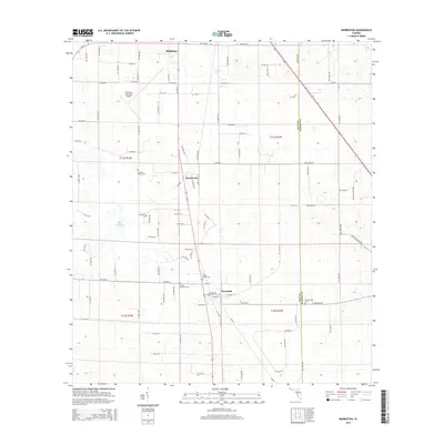
2015 Map of Morriston
USGS Topo · Published 2015About this map
Williston and Morriston anchor this portion of the Florida landscape near the Levy Co Marion Co line. The map is defined by its rural character and numerous family burial grounds, including the Sistrunk Family Cem and the Barber Family Cem. The small settlement of Montbrook sits centrally along the main transit corridor, while the Williston Municipal Airport occupies a significant tract to the northwest. This area exhibits a distinct lack of surface water, with Lake Stafford being one of the few prominent features in a terrain otherwise characterized by subtle elevation changes and an orderly grid of local roads like NE 200th Ave. Genealogists will find particular value in the dispersed sites of Plummers Cem and the Pleasant Hill Cem, which reflect the historic family-land ownership patterns of the region.
Find a feature on this map
102 named features on this map. Tap any name to fly to it.
Don’t see what you’re looking for? This feature index may not catch every label — zoom into the map to look around manually.
Map Details
Editions of this 2015 Morriston Map
This is the sole edition of this map. No revisions or reprints were ever made.
Other maps of this area

1892 · Dunnellon
USGS Topo · 1:62,500

1894 · Dunnellon
USGS Topo · 1:62,500

1895 · Williston
USGS Topo · 1:62,500

1954 · Romeo
USGS Topo · 1:24,000

1954 · Cotton Plant
USGS Topo · 1:24,000

1954 · Dunnellon
USGS Topo · 1:62,500

1954 · Gainesville
USGS Topo · 1:250,000

1955 · Tidewater
USGS Topo · 1:24,000

1955 · Bronson NE
USGS Topo · 1:24,000

1955 · Bronson SE
USGS Topo · 1:24,000