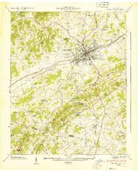
1939 Map of Morristown
USGS Topo · Published 1939About this map
Morristown serves as the central hub of this 1930s landscape, where the convergence of the Southern railroad and primary transport routes like the Andrew Johnson Highway and Dixie Highway dictated the town's expansion. The terrain is defined by the prominent Crockett Ridge and Bay S Mountain, which funnel development through valleys such as Austine Hollow. Outside the main town, the map reveals a rural economy of small settlements and local industry, from Noe Mill in the north to the Bell Quarry and the Morristown Water Plant at Hayley Springs. Genealogists will find a wealth of community landmarks, including the Emma Jarnagin Cem and numerous country schools like Manley Sch and Nelson Sch. The crossing of the Hamblen Jefferson county line at Valley Home highlights the jurisdictional boundaries that shaped early Tennessee land records.
Find a feature on this map
79 named features on this map. Tap any name to fly to it.
Don’t see what you’re looking for? This feature index may not catch every label — zoom into the map to look around manually.
Map Details
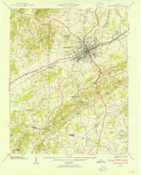
Editions of this 1939 Morristown Map
2 editions found
Other maps of this area

1883 · Morristown
USGS Topo · 1:125,000

1893 · Morristown
USGS Topo · 1:125,000

1895 · Morristown
USGS Topo · 1:125,000

1935 · White Pine
USGS Topo · 1:24,000

1935 · Rogersville
USGS Topo · 1:48,000

1935 · Tate Springs
USGS Topo · 1:48,000

1935 · Springvale
USGS Topo · 1:24,000

1935 · Avondale
USGS Topo · 1:24,000

1935 · Morristown
USGS Topo · 1:24,000

1935 · Russellville
USGS Topo · 1:24,000