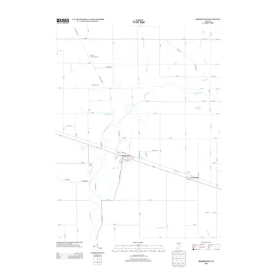
2013 Map of Morristown
USGS Topo · Published 2013About this map
The Big Blue River meanders through this portion of Shelby County, Indiana, anchoring a landscape defined by its agricultural heritage and small-town corridors. Morristown stands as the central hub, situated along the diagonal path of U.S. Route 52, which also connects to the nearby settlement of Gwynneville. The river's influence on the local topography is evident at Hog Back, a distinctive ridge overlooking the water's edge south of town.
Find a feature on this map
85 named features on this map. Tap any name to fly to it.
Don’t see what you’re looking for? This feature index may not catch every label — zoom into the map to look around manually.
Map Details
Editions of this 2013 Morristown Map
This is the sole edition of this map. No revisions or reprints were ever made.
Other maps of this area

1952 · Greenfield
USGS Topo · 1:24,000

1952 · Fountaintown
USGS Topo · 1:24,000

1953 · Shelbyville
USGS Topo · 1:24,000

1953 · Cincinnati
USGS Topo · 1:250,000

1956 · Cleveland
USGS Topo · 1:24,000

1956 · Morristown
USGS Topo · 1:24,000

1956 · Rays Crossing
USGS Topo · 1:24,000

1957 · Cincinnati
USGS Topo · 1:250,000
1960 · Manilla
USGS Topo · 1:24,000
1960 · Carthage
USGS Topo · 1:24,000