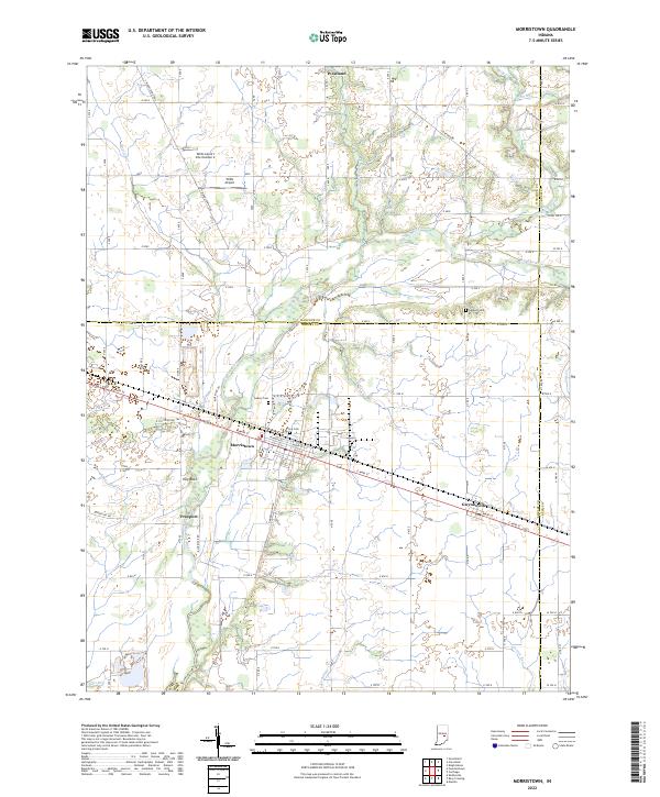
2022 Map of Morristown
USGS Topo · Published 2022About this map
The Big Blue River and its numerous tributaries, including Prairie Run and Sixmile Cr, define the agricultural and residential layout of this central Indiana landscape. At the heart of the sheet, Morristown serves as a primary settlement hub, flanked by the smaller communities of Gwynneville and Freeport. The area is marked by a legacy of early family life and settlement, evidenced by the presence of Davis Cem, Asbury Cem, and Haskett Cem.
Find a feature on this map
64 named features on this map. Tap any name to fly to it.
Don’t see what you’re looking for? This feature index may not catch every label — zoom into the map to look around manually.
Map Details
Editions of this 2022 Morristown Map
This is the sole edition of this map. No revisions or reprints were ever made.
Other maps of this area

1952 · Greenfield
USGS Topo · 1:24,000

1952 · Fountaintown
USGS Topo · 1:24,000

1953 · Shelbyville
USGS Topo · 1:24,000

1953 · Cincinnati
USGS Topo · 1:250,000

1956 · Cleveland
USGS Topo · 1:24,000

1956 · Morristown
USGS Topo · 1:24,000

1956 · Rays Crossing
USGS Topo · 1:24,000

1957 · Cincinnati
USGS Topo · 1:250,000
1960 · Manilla
USGS Topo · 1:24,000
1960 · Carthage
USGS Topo · 1:24,000