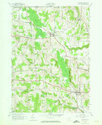
1943 Map of Morrisville
USGS Topo · Published 1973About this map
The village of Morrisville and the upland community of Peterboro anchor this mid-century portrait of Madison County. The landscape is defined by the headwaters of the Chenango River and the winding course of Oneida Creek, with distinctive wetlands like the Peterboro Swamp and The Morrisville Swamp punctuating the valley floors. In the southern portion of the sheet, the presence of the Electric Light Pond and Electric Light Stream hints at localized industrial or utility developments that powered the nearby settlements.
Find a feature on this map
39 named features on this map. Tap any name to fly to it.
Don’t see what you’re looking for? This feature index may not catch every label — zoom into the map to look around manually.
Map Details
Editions of this 1943 Morrisville Map
2 editions found

Other maps of this area

1895 · Chittenango
USGS Topo · 1:62,500

1895 · Oneida
USGS Topo · 1:62,500

1897 · Cazenovia
USGS Topo · 1:62,500

1898 · Oneida
USGS Topo · 1:62,500

1898 · Chittenango
USGS Topo · 1:62,500

1899 · Cazenovia
USGS Topo · 1:62,500

1902 · Chittenango
USGS Topo · 1:62,500

1902 · Morrisville
USGS Topo · 1:62,500

1902 · Oneida
USGS Topo · 1:62,500

1939 · Oneida
USGS Topo · 1:62,500