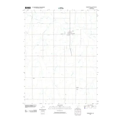
2009 Map of Morrowville
USGS Topo · Published 2009About this map
Morrowville serves as the primary hub of this north-central Kansas landscape, situated near the winding course of Mill Creek. The town is oriented around a grid of streets including Elm St, Maple St, and Locust St, with the Morrowville Cemetery located just to the west. This 2009 survey reveals a rural character defined by an extensive drainage network, where numerous tributaries like Melvin Creek, Stub Creek, and Gray Branch feed into the larger creek systems.
Find a feature on this map
31 named features on this map. Tap any name to fly to it.
Don’t see what you’re looking for? This feature index may not catch every label — zoom into the map to look around manually.
Map Details
Editions of this 2009 Morrowville Map
This is the sole edition of this map. No revisions or reprints were ever made.
Other maps of this area

1893 · Washington
USGS Topo · 1:125,000

1955 · Manhattan
USGS Topo · 1:250,000

1956 · Manhattan
USGS Topo · 1:250,000

1957 · Manhattan
USGS Topo · 1:250,000

1965 · Brantford
USGS Topo · 1:24,000
1966 · Washington NW
USGS Topo · 1:24,000

1966 · Morrowville
USGS Topo · 1:24,000

1966 · Washington
USGS Topo · 1:24,000
1966 · Washington NE
USGS Topo · 1:24,000
1966 · Haddam
USGS Topo · 1:24,000