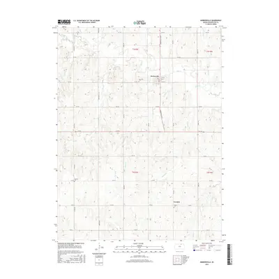
2015 Map of Morrowville
USGS Topo · Published 2015About this map
Morrowville serves as the central hub of this northern Kansas landscape, where a grid of rural roads connects scattered farmsteads and historic burial grounds. The settlement's street plan, including Elm St and Oak St, sits just north of the Morrisville Cem. Further south, the map reveals the smaller community of Enosdale, situated near the Friends Cem. The drainage patterns here are complex, defined by a network of waterways like Mill Creek, Buffalo Creek, and Peats Creek that carve through the section lines of Townships 2 and 3 South.
Find a feature on this map
42 named features on this map. Tap any name to fly to it.
Don’t see what you’re looking for? This feature index may not catch every label — zoom into the map to look around manually.
Map Details
Editions of this 2015 Morrowville Map
This is the sole edition of this map. No revisions or reprints were ever made.
Other maps of this area

1893 · Washington
USGS Topo · 1:125,000

1955 · Manhattan
USGS Topo · 1:250,000

1956 · Manhattan
USGS Topo · 1:250,000

1957 · Manhattan
USGS Topo · 1:250,000

1965 · Brantford
USGS Topo · 1:24,000
1966 · Washington NW
USGS Topo · 1:24,000

1966 · Morrowville
USGS Topo · 1:24,000

1966 · Washington
USGS Topo · 1:24,000
1966 · Washington NE
USGS Topo · 1:24,000
1966 · Haddam
USGS Topo · 1:24,000