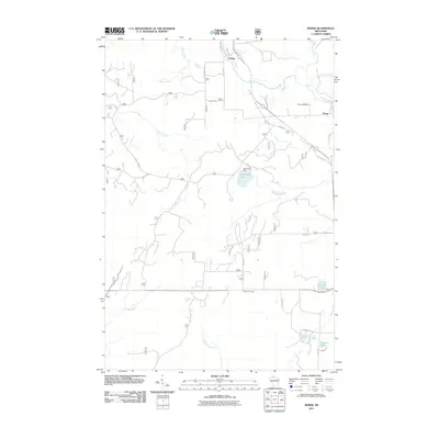
2011 Map of Morse
USGS Topo · Published 2011About this map
Morse and Cayuga anchor this Northwoods landscape where the Bad River winds through the northern reaches of the quadrangle. The 2011 survey reveals a territory defined by its water and woods, featuring a network of forest roads like For Road 351 and Forest Rd 183 that provide access to remote areas and small water bodies. Notable landmarks include the Morse Cemetery near the namesake settlement and the peculiarly named Popcorn Corners located further south along the main transit corridor.
Find a feature on this map
32 named features on this map. Tap any name to fly to it.
Don’t see what you’re looking for? This feature index may not catch every label — zoom into the map to look around manually.
Map Details
Editions of this 2011 Morse Map
This is the sole edition of this map. No revisions or reprints were ever made.
Other maps of this area

1942 · Glidden
USGS Topo · 1:48,000

1942 · Clam Lake
USGS Topo · 1:48,000

1942 · Mellen
USGS Topo · 1:48,000

1942 · Marengo
USGS Topo · 1:48,000

1945 · Marengo
USGS Topo · 1:48,000

1945 · Clam Lake
USGS Topo · 1:48,000

1945 · Glidden
USGS Topo · 1:48,000

1945 · Mellen
USGS Topo · 1:48,000

1953 · Ashland
USGS Topo · 1:250,000
1956 · Mt. Whittlesey
USGS Topo · 1:24,000