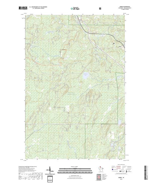
2023 Map of Morse
USGS Topo · Published 2023About this map
The northern forests of Ashland County are defined by a complex network of waterways, including the Bad River and the meandering Moose River. In the northern section of the map, the small settlements of Cayuga and Morse represent the primary points of human habitation within the larger expanse of the Chequamegon National Forest. The landscape is largely undeveloped, characterized by a mix of wetlands and timberland drained by numerous creeks such as Washashki-ziibiins and Muskellunge Creek.
Find a feature on this map
28 named features on this map. Tap any name to fly to it.
Don’t see what you’re looking for? This feature index may not catch every label — zoom into the map to look around manually.
Map Details
Editions of this 2023 Morse Map
This is the sole edition of this map. No revisions or reprints were ever made.
Other maps of this area

1942 · Glidden
USGS Topo · 1:48,000

1942 · Clam Lake
USGS Topo · 1:48,000

1942 · Mellen
USGS Topo · 1:48,000

1942 · Marengo
USGS Topo · 1:48,000

1945 · Marengo
USGS Topo · 1:48,000

1945 · Clam Lake
USGS Topo · 1:48,000

1945 · Glidden
USGS Topo · 1:48,000

1945 · Mellen
USGS Topo · 1:48,000

1953 · Ashland
USGS Topo · 1:250,000
1956 · Mt. Whittlesey
USGS Topo · 1:24,000