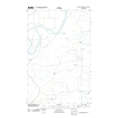
2011 Map of Mortarstone Bluff
USGS Topo · Published 2011About this map
The Missouri River winds through this section of the Missouri River Breaks, carving a complex landscape of deep coulees and distinct topographic landmarks. This 2011 survey documents a sparsely settled region of Roosevelt County where the terrain is the primary feature, defined by formations like Mortarstone Bluff and the prominent Haystack Butte. The drainage network is particularly intricate here, with numerous seasonal runs such as Eagles Nest Coulee, Coalmine Coulee, and Schoolhouse Coulee feeding into larger systems like West Charlie Creek.
Find a feature on this map
22 named features on this map. Tap any name to fly to it.
Don’t see what you’re looking for? This feature index may not catch every label — zoom into the map to look around manually.
Map Details
Editions of this 2011 Mortarstone Bluff Map
This is the sole edition of this map. No revisions or reprints were ever made.
Other maps of this area

1909 · Glendive
USGS Topo · 1:250,000

1912 · Poplar
USGS Topo · 1:62,500

1914 · Brockton
USGS Topo · 1:62,500

1950 · Calais
USGS Topo · 1:24,000

1954 · Glendive
USGS Topo · 1:250,000

1954 · Wolf Point
USGS Topo · 1:250,000

1957 · Glendive
USGS Topo · 1:250,000

1958 · Wolf Point
USGS Topo · 1:250,000

1958 · Glendive
USGS Topo · 1:250,000

1972 · Poplar NE
USGS Topo · 1:24,000