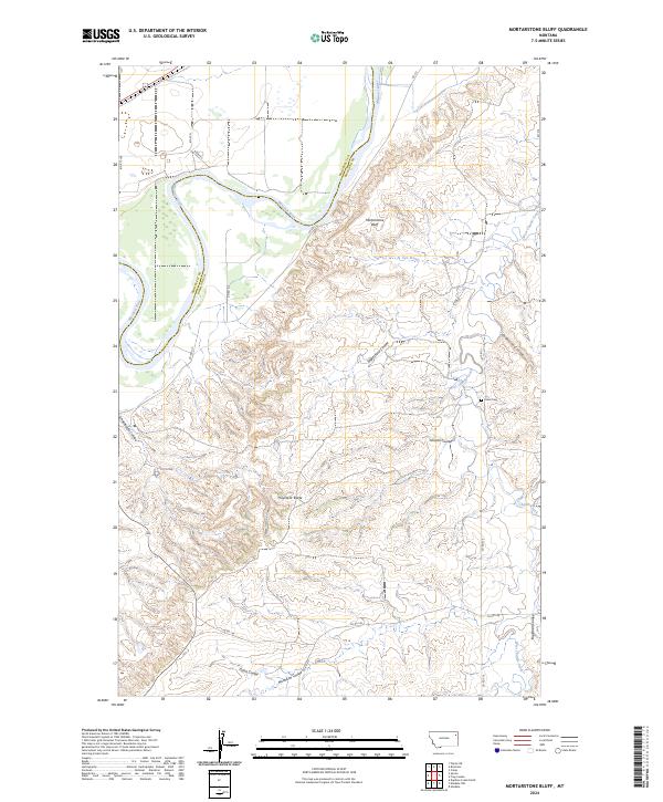
2024 Map of Mortarstone Bluff
USGS Topo · Published 2024About this map
The Missouri River carves through the northern reaches of this landscape, marking the boundary where Roosevelt and Richland counties meet. This modern survey illustrates a rugged topography defined by deeply incised drainages and named coulees that feed into larger waterways. Significant terrain features like Mortarstone Bluff and the prominent Haystack Butte rise above the surrounding prairie, providing clear landmarks in a region largely defined by its natural hydrology and relief.
Find a feature on this map
22 named features on this map. Tap any name to fly to it.
Don’t see what you’re looking for? This feature index may not catch every label — zoom into the map to look around manually.
Map Details
Editions of this 2024 Mortarstone Bluff Map
This is the sole edition of this map. No revisions or reprints were ever made.
Other maps of this area

1909 · Glendive
USGS Topo · 1:250,000

1912 · Poplar
USGS Topo · 1:62,500

1914 · Brockton
USGS Topo · 1:62,500

1950 · Calais
USGS Topo · 1:24,000

1954 · Glendive
USGS Topo · 1:250,000

1954 · Wolf Point
USGS Topo · 1:250,000

1957 · Glendive
USGS Topo · 1:250,000

1958 · Wolf Point
USGS Topo · 1:250,000

1958 · Glendive
USGS Topo · 1:250,000

1972 · Poplar NE
USGS Topo · 1:24,000