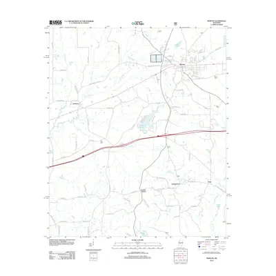
2012 Map of Morton
USGS Topo · Published 2012About this map
The town of Morton serves as the central hub of this Scott County landscape, situated where the railroad corridor and Old Highway 80 parallel each other across the northern half of the quadrangle. The settlement pattern extends southward through small communities and historical crossroads such as Clarkburg, Kracker Station, and Independence. This 2012 survey illustrates a transition from the structured residential blocks of the town center to a more dispersed rural network defined by family-named roads like Davis Farm Rd and Rankin Ferguson Rd.
Find a feature on this map
74 named features on this map. Tap any name to fly to it.
Don’t see what you’re looking for? This feature index may not catch every label — zoom into the map to look around manually.
Map Details
Editions of this 2012 Morton Map
This is the sole edition of this map. No revisions or reprints were ever made.
Other maps of this area

1922 · Morton
USGS Topo · 1:48,000

1922 · Pelahatchee
USGS Topo · 1:48,000

1924 · Pelahatchee
USGS Topo · 1:62,500

1924 · Morton
USGS Topo · 1:62,500

1950 · Pelahatchie
USGS Topo · 1:62,500

1951 · Morton
USGS Topo · 1:62,500

1952 · Pelahatchie
USGS Topo · 1:62,500

1953 · Meridian
USGS Topo · 1:250,000

1957 · Meridian
USGS Topo · 1:250,000

1965 · Meridian
USGS Topo · 1:250,000