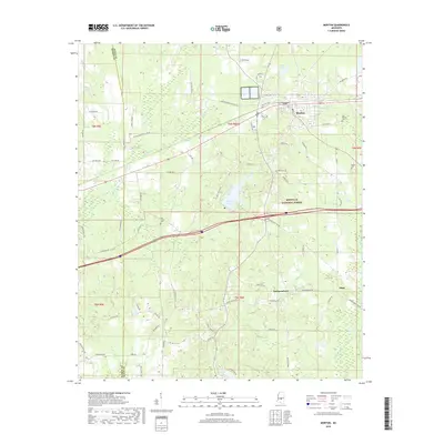
2018 Map of Morton
USGS Topo · Published 2018About this map
Morton serves as a central hub in Scott County, where the grid of town streets meets the expansive timberlands of the Bienville National Forest. The landscape is defined by the headwaters and tributaries of several drainage systems, including the westward-flowing Pelahatchie Creek and the southern reaches of the Strong River. These watercourses, along with smaller bodies like Shadow Lake and Mill Pond, dictate the winding paths of rural routes such as Lindsey Rd and Old Hwy 80. Smaller community clusters like Independence and Stage are found in the southern half of the map, connected by roads that navigate the subtle rises between creek beds. For those documenting local families, several burial grounds are scattered throughout the area, including East Morton Cem, Walker Cem, and Line Creek Cem, which often represent the early centers of settlement for these rural Mississippi communities.
Find a feature on this map
75 named features on this map. Tap any name to fly to it.
Don’t see what you’re looking for? This feature index may not catch every label — zoom into the map to look around manually.
Map Details
Editions of this 2018 Morton Map
This is the sole edition of this map. No revisions or reprints were ever made.
Other maps of this area

1922 · Morton
USGS Topo · 1:48,000

1922 · Pelahatchee
USGS Topo · 1:48,000

1924 · Pelahatchee
USGS Topo · 1:62,500

1924 · Morton
USGS Topo · 1:62,500

1950 · Pelahatchie
USGS Topo · 1:62,500

1951 · Morton
USGS Topo · 1:62,500

1952 · Pelahatchie
USGS Topo · 1:62,500

1953 · Meridian
USGS Topo · 1:250,000

1957 · Meridian
USGS Topo · 1:250,000

1965 · Meridian
USGS Topo · 1:250,000