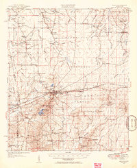
1951 Map of Morton
USGS Topo · Published 1951About this map
Morton sits as a central hub in central Mississippi, where the Illinois Central Railroad and several early regional roads converge. The landscape is defined by the vast reach of the Bienville National Forest and the recreational waters of Roosevelt State Park. Away from the rail line, the map preserves a network of rural communities such as Forkville, Hillsboro, and Pulaski, each anchored by small country schools and churches like Simmons Grove Ch and Pleasant Gift Ch.
Find a feature on this map
73 named features on this map. Tap any name to fly to it.
Don’t see what you’re looking for? This feature index may not catch every label — zoom into the map to look around manually.
Map Details
Editions of this 1951 Morton Map
3 editions found
Other maps of this area

1921 · Forest
USGS Topo · 1:48,000

1922 · Forest
USGS Topo · 1:62,500

1922 · Morton
USGS Topo · 1:48,000

1922 · Pelahatchee
USGS Topo · 1:48,000

1924 · Pelahatchee
USGS Topo · 1:62,500

1924 · Morton
USGS Topo · 1:62,500

1950 · Forest
USGS Topo · 1:62,500

1950 · Pelahatchie
USGS Topo · 1:62,500

1951 · Morton
USGS Topo · 1:62,500

1952 · Pelahatchie
USGS Topo · 1:62,500