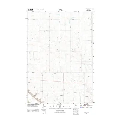
2013 Map of Morton SE
USGS Topo · Published 2013About this map
Finnish Cem and Gilbert Borth Cem are among several historic burial sites located within this agricultural landscape in Renville County. The terrain is defined by a sophisticated water management network, including County Ditch Number One Hundred Fifteen and County Ditch Number One Hundred Nine A, which support the region's productive farmland. These man-made channels complement natural drainage like Fort Ridgely Cr and Threemile Cr. The map shows a rural area where local heritage is preserved in family and community landmarks such as Hauges Cem and the Ft Ridgely and Dale Cem. Modern agricultural operations, including Nosbush Dairy, sit alongside these established sites, connected by a grid of county roads and MN-19.
Find a feature on this map
29 named features on this map. Tap any name to fly to it.
Don’t see what you’re looking for? This feature index may not catch every label — zoom into the map to look around manually.
Map Details
Editions of this 2013 Morton SE Map
This is the sole edition of this map. No revisions or reprints were ever made.
Other maps of this area

1952 · Morton
USGS Topo · 1:62,500

1953 · Morgan
USGS Topo · 1:62,500

1953 · New Ulm
USGS Topo · 1:250,000

1957 · New Ulm
USGS Topo · 1:250,000

1958 · New Ulm
USGS Topo · 1:250,000

1964 · Fairfax
USGS Topo · 1:24,000

1964 · Sleepy Eye NW
USGS Topo · 1:24,000

1964 · Hector
USGS Topo · 1:24,000

1967 · New Ulm
USGS Topo · 1:250,000
1982 · Morgan NE
USGS Topo · 1:24,000