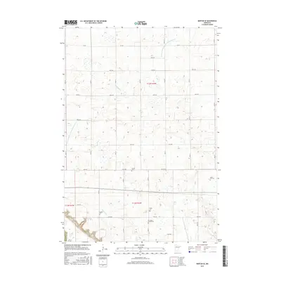
2016 Map of Morton SE
USGS Topo · Published 2016About this map
Renville County farmland is defined here by a systematic network of drainage infrastructure and rural burial grounds. The agricultural landscape is divided by watercourses like Threemile Cr and Fort Ridgely Cr, alongside an extensive series of engineered channels including County Ditch Number One Hundred Fifteen and County Ditch Number One Hundred Nine A. These waterways suggest the significant effort required to manage the prairie hydrology for large-scale cultivation.
Find a feature on this map
25 named features on this map. Tap any name to fly to it.
Don’t see what you’re looking for? This feature index may not catch every label — zoom into the map to look around manually.
Map Details
Editions of this 2016 Morton SE Map
This is the sole edition of this map. No revisions or reprints were ever made.
Other maps of this area

1952 · Morton
USGS Topo · 1:62,500

1953 · Morgan
USGS Topo · 1:62,500

1953 · New Ulm
USGS Topo · 1:250,000

1957 · New Ulm
USGS Topo · 1:250,000

1958 · New Ulm
USGS Topo · 1:250,000

1964 · Fairfax
USGS Topo · 1:24,000

1964 · Sleepy Eye NW
USGS Topo · 1:24,000

1964 · Hector
USGS Topo · 1:24,000

1967 · New Ulm
USGS Topo · 1:250,000
1982 · Morgan NE
USGS Topo · 1:24,000