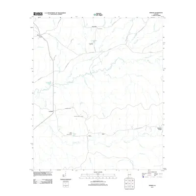
2011 Map of Morvin
USGS Topo · Published 2011About this map
Tallahatta Creek and its many tributaries, including Bashi Creek and Rush Creek, define this rural Marengo County landscape. Small settlements and local landmarks are scattered across the terrain, connected by rural routes such as County Hwy 48 and Tallahatta Springs Rd. The presence of the Tallahatta Cemetery for Blacks, Lucker Cemetery, and Bashan Cemetery provide essential points of reference for genealogists and local historians tracking family roots in this part of Alabama.
Find a feature on this map
48 named features on this map. Tap any name to fly to it.
Don’t see what you’re looking for? This feature index may not catch every label — zoom into the map to look around manually.
Map Details
Editions of this 2011 Morvin Map
This is the sole edition of this map. No revisions or reprints were ever made.
Other maps of this area

1953 · Montgomery
USGS Topo · 1:250,000

1953 · Andalusia
USGS Topo · 1:250,000

1953 · Hattiesburg
USGS Topo · 1:250,000

1953 · Meridian
USGS Topo · 1:250,000

1956 · Montgomery
USGS Topo · 1:250,000

1957 · Meridian
USGS Topo · 1:250,000

1957 · Montgomery
USGS Topo · 1:250,000

1957 · Andalusia
USGS Topo · 1:250,000

1958 · Hattiesburg
USGS Topo · 1:250,000

1965 · Meridian
USGS Topo · 1:250,000