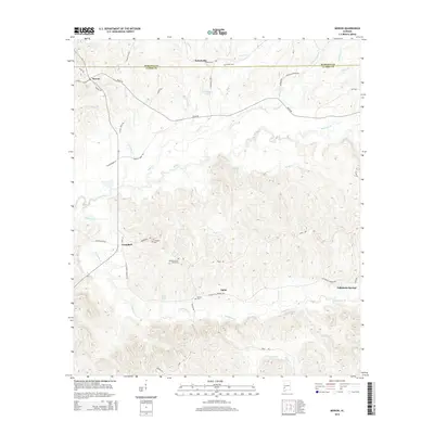
2014 Map of Morvin
USGS Topo · Published 2014About this map
Tallahatta Springs and the surrounding rural communities of Morvin and Hotamville define this portion of the Alabama landscape near the boundary of Marengo and Clarke counties. The terrain is deeply carved by a network of watercourses, most notably the meandering Rush Cr and Tallahatta Cr, which draw toward the southwestern corner of the quadrangle. For genealogists and local historians, the map preserves the locations of several community burial grounds, including the Tallahatta Cem for Blacks, Bashan Cem, and Lucker Cem. This 2014 survey documents a region where life follows the ridges and creek valleys, with small clusters of development like Opine and Campbell linked by a web of local routes such as Tallahatta Springs Rd and Bashi Rd. The presence of Opine Lake and N S Haltam Lake suggests the importance of water management in this predominantly agricultural and forested area.
Find a feature on this map
52 named features on this map. Tap any name to fly to it.
Don’t see what you’re looking for? This feature index may not catch every label — zoom into the map to look around manually.
Map Details
Editions of this 2014 Morvin Map
This is the sole edition of this map. No revisions or reprints were ever made.
Other maps of this area

1953 · Montgomery
USGS Topo · 1:250,000

1953 · Andalusia
USGS Topo · 1:250,000

1953 · Hattiesburg
USGS Topo · 1:250,000

1953 · Meridian
USGS Topo · 1:250,000

1956 · Montgomery
USGS Topo · 1:250,000

1957 · Meridian
USGS Topo · 1:250,000

1957 · Montgomery
USGS Topo · 1:250,000

1957 · Andalusia
USGS Topo · 1:250,000

1958 · Hattiesburg
USGS Topo · 1:250,000

1965 · Meridian
USGS Topo · 1:250,000