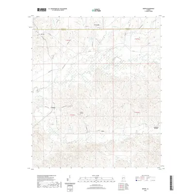
2020 Map of Morvin
USGS Topo · Published 2020About this map
Hotamville and Morvin sit along the high ground of the Alabama coastal plain, straddling the border of Marengo and Clarke counties. This landscape is defined by its complex drainage network, where Bashi Creek and Tallahatta Creek wind through heavily dissected terrain. Historically significant sites like the Tallahatta Cem African American and Bashan Cem are preserved in the rural landscape, alongside small settlements such as Campbell and Opine. The map reveals a remote, resource-oriented interior where many smaller water bodies, including N S Hallam Lake and Opine Lake, are tucked away from the primary county roads. The presence of Tallahatta Springs on the eastern edge points toward the area's geological character, where mineral springs were often focal points for local communities.
Find a feature on this map
54 named features on this map. Tap any name to fly to it.
Don’t see what you’re looking for? This feature index may not catch every label — zoom into the map to look around manually.
Map Details
Editions of this 2020 Morvin Map
This is the sole edition of this map. No revisions or reprints were ever made.
Other maps of this area

1953 · Montgomery
USGS Topo · 1:250,000

1953 · Andalusia
USGS Topo · 1:250,000

1953 · Hattiesburg
USGS Topo · 1:250,000

1953 · Meridian
USGS Topo · 1:250,000

1956 · Montgomery
USGS Topo · 1:250,000

1957 · Meridian
USGS Topo · 1:250,000

1957 · Montgomery
USGS Topo · 1:250,000

1957 · Andalusia
USGS Topo · 1:250,000

1958 · Hattiesburg
USGS Topo · 1:250,000

1965 · Meridian
USGS Topo · 1:250,000