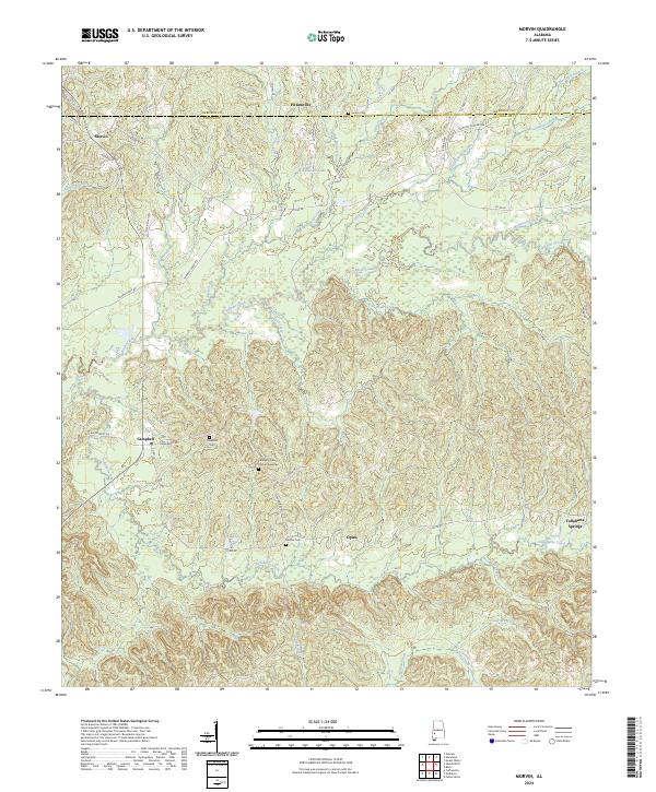
2024 Map of Morvin
USGS Topo · Published 2024About this map
Tallahatta Springs and the rural communities of Clarke and Marengo Counties are defined by a complex network of creeks and branches that navigate the undulating terrain of southwest Alabama. The landscape is dotted with small settlements like Morvin, Hotamville, and Opine, connected by legacy routes such as Co Rd 48 and Strawberry Rd. Evidence of the area's social history and family lineage is preserved in localized landmarks, including the Tallahatta Cem African American and Bashan Cem. The drainage patterns of Bashi Creek and Tallahatta Creek illustrate the natural irrigation that sustained these timber and agricultural communities. This modern survey provides a detailed look at the rural intersection of Township 11 and 12 North, capturing the persistence of these small Alabama hamlets.
Find a feature on this map
50 named features on this map. Tap any name to fly to it.
Don’t see what you’re looking for? This feature index may not catch every label — zoom into the map to look around manually.
Map Details
Editions of this 2024 Morvin Map
This is the sole edition of this map. No revisions or reprints were ever made.
Other maps of this area

1953 · Montgomery
USGS Topo · 1:250,000

1953 · Andalusia
USGS Topo · 1:250,000

1953 · Hattiesburg
USGS Topo · 1:250,000

1953 · Meridian
USGS Topo · 1:250,000

1956 · Montgomery
USGS Topo · 1:250,000

1957 · Meridian
USGS Topo · 1:250,000

1957 · Montgomery
USGS Topo · 1:250,000

1957 · Andalusia
USGS Topo · 1:250,000

1958 · Hattiesburg
USGS Topo · 1:250,000

1965 · Meridian
USGS Topo · 1:250,000