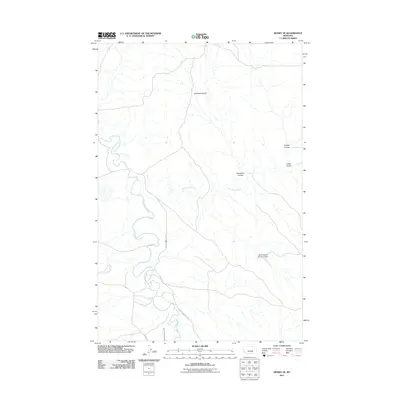
2011 Map of Mosby SE
USGS Topo · Published 2011About this map
The Musselshell River winds through this Rosebud County landscape, defining the western portion of the terrain with its characteristic tight oxbow loops. This 2011 survey captures the drainage patterns of the high plains, where numerous coulees, such as Nineteen Coulee and Youderian Coulee, carve through the earth toward the river valley. The infrastructure of the ranching and agricultural economy is evident in the presence of the BS Kincheloe Number 3 Dam and the Delphia Melstone Ditch, which redirect water through this arid region. Family names tied to the land are preserved in the road network, including Wendel Kincheloe Rd, providing a record of local land use and tenure in the early 21st century.
Find a feature on this map
10 named features on this map. Tap any name to fly to it.
Don’t see what you’re looking for? This feature index may not catch every label — zoom into the map to look around manually.
Map Details
Editions of this 2011 Mosby SE Map
This is the sole edition of this map. No revisions or reprints were ever made.
Other maps of this area

1954 · Forsyth
USGS Topo · 1:250,000

1957 · Forsyth
USGS Topo · 1:250,000

1958 · Forsyth
USGS Topo · 1:250,000

1962 · Mosby
USGS Topo · 1:24,000

1962 · Melstone NE
USGS Topo · 1:24,000

1962 · Maxwell Ranch
USGS Topo · 1:24,000

1962 · Melstone NW
USGS Topo · 1:24,000

1962 · Kincheloe Ranch
USGS Topo · 1:24,000

1962 · Mosby SE
USGS Topo · 1:24,000

1962 · Grebe Ranch
USGS Topo · 1:24,000