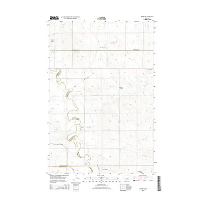
2014 Map of Mosby SE
USGS Topo · Published 2014About this map
The Musselshell River winds through this sparsely settled corner of central Montana, marking a complex intersection of Rosebud, Petroleum, Garfield, and Musselshell counties. The landscape is defined by its drainage patterns, where significant seasonal watercourses like Rattlesnake Cr and Rattlesnake Coulee carve through the high plains. Named geographical features such as Youderian Coulee, Nineteen Coulee, and Turner Coulee suggest the legacy of early ranching families and local landmarks in this rural ranching district. Infrastructure is limited to a few arterial routes, including Melstone Rd, Mosby Rd, and Wendel Kincheloe Rd, which provide the primary connectivity across the wide-open terrain of the Big Sky country during this early 21st-century period.
Find a feature on this map
19 named features on this map. Tap any name to fly to it.
Don’t see what you’re looking for? This feature index may not catch every label — zoom into the map to look around manually.
Map Details
Editions of this 2014 Mosby SE Map
This is the sole edition of this map. No revisions or reprints were ever made.
Other maps of this area

1954 · Forsyth
USGS Topo · 1:250,000

1957 · Forsyth
USGS Topo · 1:250,000

1958 · Forsyth
USGS Topo · 1:250,000

1962 · Mosby
USGS Topo · 1:24,000

1962 · Melstone NE
USGS Topo · 1:24,000

1962 · Maxwell Ranch
USGS Topo · 1:24,000

1962 · Melstone NW
USGS Topo · 1:24,000

1962 · Kincheloe Ranch
USGS Topo · 1:24,000

1962 · Mosby SE
USGS Topo · 1:24,000

1962 · Grebe Ranch
USGS Topo · 1:24,000