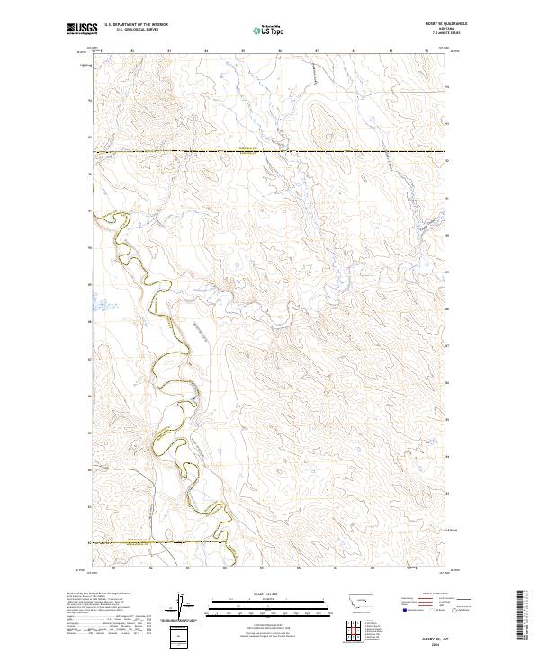
2024 Map of Mosby SE
USGS Topo · Published 2024About this map
The Musselshell River meanders through this landscape, defining a complex border where Rosebud, Petroleum, and Garfield counties converge. The terrain is deeply incised by a network of drainage systems, including Rattlesnake Creek and various coulees such as Turner Coulee, Youderian Coulee, and Cooper Coulee. These features highlight the erosional patterns typical of this Montana region, where water and time have carved distinct pathways through the earth.
Find a feature on this map
16 named features on this map. Tap any name to fly to it.
Don’t see what you’re looking for? This feature index may not catch every label — zoom into the map to look around manually.
Map Details
Editions of this 2024 Mosby SE Map
This is the sole edition of this map. No revisions or reprints were ever made.
Other maps of this area

1954 · Forsyth
USGS Topo · 1:250,000

1957 · Forsyth
USGS Topo · 1:250,000

1958 · Forsyth
USGS Topo · 1:250,000

1962 · Mosby
USGS Topo · 1:24,000

1962 · Melstone NE
USGS Topo · 1:24,000

1962 · Maxwell Ranch
USGS Topo · 1:24,000

1962 · Melstone NW
USGS Topo · 1:24,000

1962 · Kincheloe Ranch
USGS Topo · 1:24,000

1962 · Mosby SE
USGS Topo · 1:24,000

1962 · Grebe Ranch
USGS Topo · 1:24,000