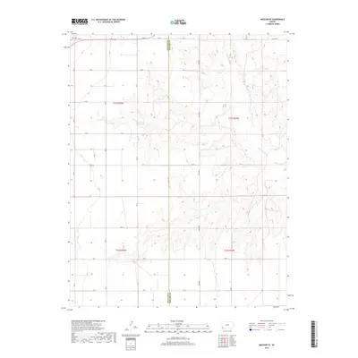
2018 Map of Moscow SE
USGS Topo · Published 2018About this map
The Cimarron River winds through the High Plains landscape of Southwest Kansas, cutting a distinct path across this 2018 survey. The terrain is defined by the sharp boundary between Stevens Co and Seward Co, a line that bisects the map and organizes the regional section-line road system. This grid of local routes, including Road W and 23 Mile Rd, reflects the enduring agrarian layout of the territory. For those tracing family histories or early rural life, the O'Dea Cem in the northwest corner stands as a primary point of interest. The southern portion of the sheet is marked by Marteney, emphasizing the localized naming conventions that still dominate this section of the state.
Find a feature on this map
28 named features on this map. Tap any name to fly to it.
Don’t see what you’re looking for? This feature index may not catch every label — zoom into the map to look around manually.
Map Details
Editions of this 2018 Moscow SE Map
This is the sole edition of this map. No revisions or reprints were ever made.
Other maps of this area

1944 · Moscow
USGS Topo · 1:62,500

1945 · Moscow
USGS Topo · 1:62,500

1955 · Dodge City
USGS Topo · 1:250,000

1958 · Dodge City
USGS Topo · 1:250,000

1959 · Dodge City
USGS Topo · 1:250,000

1968 · Sublette SW
USGS Topo · 1:24,000
1968 · Satanta
USGS Topo · 1:24,000

1968 · Liberal NW
USGS Topo · 1:24,000
1974 · Moscow SE
USGS Topo · 1:24,000
1974 · Moscow
USGS Topo · 1:24,000