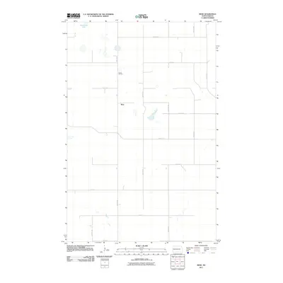
2011 Map of Mose
USGS Topo · Published 2011About this map
The small settlement of Mose centers this rural Griggs County landscape, which is defined by the high plains of eastern North Dakota. The area's character is shaped by a grid of local section roads, including 98th Ave NE and 11th St NE, that provide access to the surrounding agricultural land. One of the map's most distinct cultural landmarks is Naroen Cemetery, situated north of the town site along 99th Ave NE, serving as a significant point of reference for family historians and genealogists in the region.
Find a feature on this map
19 named features on this map. Tap any name to fly to it.
Don’t see what you’re looking for? This feature index may not catch every label — zoom into the map to look around manually.
Map Details
Editions of this 2011 Mose Map
This is the sole edition of this map. No revisions or reprints were ever made.
Other maps of this area

1900 · Pingree
USGS Topo · 1:125,000

1951 · Glenfield
USGS Topo · 1:24,000

1952 · New Rockford
USGS Topo · 1:250,000

1956 · New Rockford
USGS Topo · 1:250,000

1961 · McHenry
USGS Topo · 1:24,000

1961 · Binford
USGS Topo · 1:24,000

1961 · Sutton
USGS Topo · 1:24,000

1961 · Johnson Lake
USGS Topo · 1:24,000

1961 · Binford NE
USGS Topo · 1:24,000
1961 · Binford NW
USGS Topo · 1:24,000