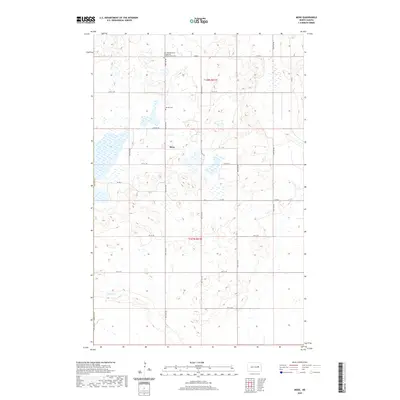
2020 Map of Mose
USGS Topo · Published 2020About this map
Mose sits at the heart of this agricultural landscape in Griggs County, where the prairie is defined by a dense network of sectional roads and glacial wetlands. The map provides significant genealogical value through its marking of local burial sites, most notably the Zion Skandanavian Evangelical Lutheran Kirke Cem in the north and the Naroen Cem near the center of the township. These landmarks, along with the meandering path of Baldhill Cr in the southwest, illustrate the late 20th-century settlement patterns of eastern North Dakota. The landscape is organized by a precise grid of maintained routes, including Co Rd 2 and Co Rd 8, which connect the isolated farmsteads and small communities that have sustained this region for generations.
Find a feature on this map
21 named features on this map. Tap any name to fly to it.
Don’t see what you’re looking for? This feature index may not catch every label — zoom into the map to look around manually.
Map Details
Editions of this 2020 Mose Map
This is the sole edition of this map. No revisions or reprints were ever made.
Other maps of this area

1900 · Pingree
USGS Topo · 1:125,000

1951 · Glenfield
USGS Topo · 1:24,000

1952 · New Rockford
USGS Topo · 1:250,000

1956 · New Rockford
USGS Topo · 1:250,000

1961 · McHenry
USGS Topo · 1:24,000

1961 · Binford
USGS Topo · 1:24,000

1961 · Sutton
USGS Topo · 1:24,000

1961 · Johnson Lake
USGS Topo · 1:24,000

1961 · Binford NE
USGS Topo · 1:24,000
1961 · Binford NW
USGS Topo · 1:24,000