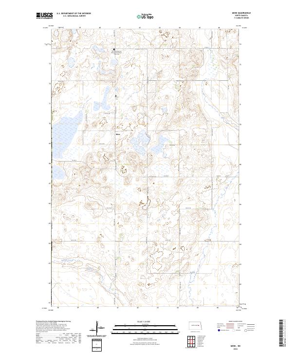
2024 Map of Mose
USGS Topo · Published 2024About this map
The small settlement of Mose anchors this part of Griggs County, where the landscape is defined by the winding path of Baldhill Creek and numerous wetlands. For genealogists and family historians, the presence of the Zion Skandanavian Evangelical Lutheran Kirke Cem and the Naroen Cem provides specific points of interest tied to the region's Scandinavian heritage. This 2024 survey captures a rural environment heavily dedicated to conservation, as evidenced by the large tracts of the Griggs County Waterfowl Production Area and the Foster County Waterfowl Production Area. The sectional grid is clearly defined by local routes such as Co Rd 2 and 9th St NE, illustrating the persistent agrarian structure of central North Dakota.
Find a feature on this map
19 named features on this map. Tap any name to fly to it.
Don’t see what you’re looking for? This feature index may not catch every label — zoom into the map to look around manually.
Map Details
Editions of this 2024 Mose Map
This is the sole edition of this map. No revisions or reprints were ever made.
Other maps of this area

1900 · Pingree
USGS Topo · 1:125,000

1951 · Glenfield
USGS Topo · 1:24,000

1952 · New Rockford
USGS Topo · 1:250,000

1956 · New Rockford
USGS Topo · 1:250,000

1961 · McHenry
USGS Topo · 1:24,000

1961 · Binford
USGS Topo · 1:24,000

1961 · Sutton
USGS Topo · 1:24,000

1961 · Johnson Lake
USGS Topo · 1:24,000

1961 · Binford NE
USGS Topo · 1:24,000
1961 · Binford NW
USGS Topo · 1:24,000