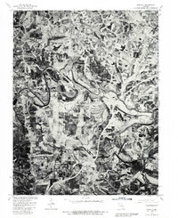
1980 Map of Moselle
USGS Topo · Published 1982About this map
The Bourbeuse River snakes through the heart of this landscape, its tight meanders carving a distinct path through the timbered hills and agricultural clearings of Franklin County. Recorded through high-altitude aerial photography in 1980, this orthophotoquad captures the transition between the rolling uplands and the river valley. The settlement of Moselle anchors the southeastern corner, while Villa Ridge and Gildehouse occupy higher ground to the north.
Find a feature on this map
5 named features on this map. Tap any name to fly to it.
Don’t see what you’re looking for? This feature index may not catch every label — zoom into the map to look around manually.
Map Details
Editions of this 1980 Moselle Map
This is the sole edition of this map. No revisions or reprints were ever made.
Other maps of this area

1890 · Hermann
USGS Topo · 1:125,000

1901 · De Soto
USGS Topo · 1:125,000

1903 · O'Fallon
USGS Topo · 1:125,000

1903 · Sullivan
USGS Topo · 1:125,000

1946 · Union
USGS Topo · 1:62,500

1947 · St. Clair
USGS Topo · 1:62,500

1948 · Union
USGS Topo · 1:62,500

1948 · Washington
USGS Topo · 1:62,500

1948 · Augusta
USGS Topo · 1:62,500

1949 · Saint Louis
USGS Topo · 1:250,000