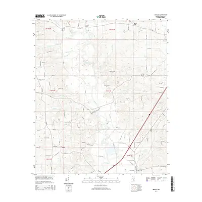
2015 Map of Moselle
USGS Topo · Published 2015About this map
The Leaf River carves a winding path through this portion of Jones County, defining the landscape between Sand Hill and the community of Moselle. The settlement pattern is characterized by numerous family-named roads and landmarks, reflecting a deep-rooted rural geography. Historic crossings like Cranfords Bridge and Crosby Bridge connect the riverbanks, while the presence of several established burial grounds, including New Bethany Cem, Pine Grove Cem, and Jordan Cem, provides significant touchpoints for genealogical research. The road network, including Moselle-Seminary RD and Riverside Church Rd, suggests the importance of community institutions like schools and churches in this timber and river-focused region. Tributaries such as Snows Cr and Four Forks Cr further dissect the terrain, creating a complex drainage system that has influenced local land use for generations.
Find a feature on this map
113 named features on this map. Tap any name to fly to it.
Don’t see what you’re looking for? This feature index may not catch every label — zoom into the map to look around manually.
Map Details
Editions of this 2015 Moselle Map
This is the sole edition of this map. No revisions or reprints were ever made.
Other maps of this area

1953 · Hattiesburg
USGS Topo · 1:250,000

1958 · Hattiesburg
USGS Topo · 1:250,000

1963 · Barrontown
USGS Topo · 1:24,000

1964 · Laurel West
USGS Topo · 1:24,000

1964 · Seminary
USGS Topo · 1:24,000

1964 · Ellisville
USGS Topo · 1:24,000

1965 · Hebron
USGS Topo · 1:24,000

1965 · Eastabuchie
USGS Topo · 1:24,000

1965 · Hot Coffee
USGS Topo · 1:24,000

1965 · Moselle
USGS Topo · 1:24,000