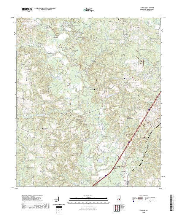
2024 Map of Moselle
USGS Topo · Published 2024About this map
Moselle sits along the southern edge of this Jones County landscape, where the Leaf River carves a winding path through the Mississippi piney woods. The river dominates the geography, evidenced by historic crossing points like Windham Ferry and Haskins Ferry. These ferries served a network of rural settlements and family homesteads connected by a dense web of local roads, including Moselle-Seminary Rd and Riverside Church Rd.
Find a feature on this map
118 named features on this map. Tap any name to fly to it.
Don’t see what you’re looking for? This feature index may not catch every label — zoom into the map to look around manually.
Map Details
Editions of this 2024 Moselle Map
This is the sole edition of this map. No revisions or reprints were ever made.
Other maps of this area

1953 · Hattiesburg
USGS Topo · 1:250,000

1958 · Hattiesburg
USGS Topo · 1:250,000

1963 · Barrontown
USGS Topo · 1:24,000

1964 · Laurel West
USGS Topo · 1:24,000

1964 · Seminary
USGS Topo · 1:24,000

1964 · Ellisville
USGS Topo · 1:24,000

1965 · Hebron
USGS Topo · 1:24,000

1965 · Eastabuchie
USGS Topo · 1:24,000

1965 · Hot Coffee
USGS Topo · 1:24,000

1965 · Moselle
USGS Topo · 1:24,000