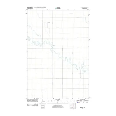
2011 Map of Moselle
USGS Topo · Published 2011About this map
Wild Rice River meanders across this rural landscape, carving a complex path through the heart of Belford Township. The settlement of Moselle stands in the northern reaches, a quiet point in a vast grid of section lines and agricultural roads like County Rd 14 and 159th Ave SE. Near one of the river's many oxbow bends, the Nulph Cemetery remains a significant marker of local heritage and early settler history. The terrain is further defined by the drainage of Elk Creek and the South Branch Antelope Creek, illustrating the natural hydrology that shaped the development of this Richland County corner. This survey documents the area just after the first decade of the 21st century, showing the enduring structure of the North Dakota prairie.
Find a feature on this map
19 named features on this map. Tap any name to fly to it.
Don’t see what you’re looking for? This feature index may not catch every label — zoom into the map to look around manually.
Map Details
Editions of this 2011 Moselle Map
This is the sole edition of this map. No revisions or reprints were ever made.
Other maps of this area

1904 · Wahpeton
USGS Topo · 1:125,000

1907 · Wyndmere
USGS Topo · 1:125,000

1953 · Fargo
USGS Topo · 1:250,000

1956 · Fargo
USGS Topo · 1:250,000

1960 · Wyndmere
USGS Topo · 1:24,000

1960 · Mooreton West
USGS Topo · 1:24,000

1960 · Wyndmere SE
USGS Topo · 1:24,000

1964 · Kreiser Lake
USGS Topo · 1:24,000

1964 · Hankinson
USGS Topo · 1:24,000

1964 · Mantador
USGS Topo · 1:24,000