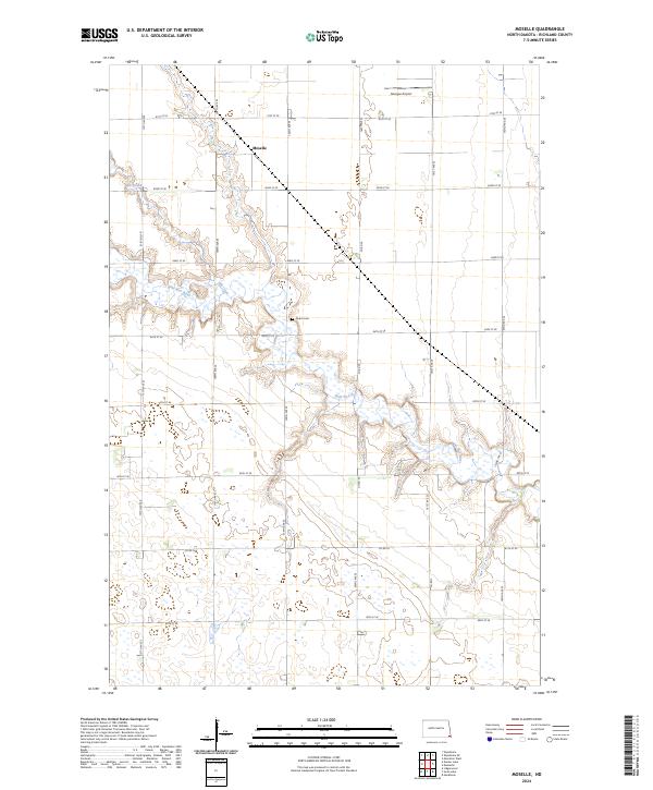
2024 Map of Moselle
USGS Topo · Published 2024About this map
The Moselle area of Richland County is defined by the winding course of the Wild Rice River, which meanders across the landscape alongside Elk Creek. This rural North Dakota terrain is segmented by a precise grid of section roads, including 81st St SE through 88th St SE, reflecting the deep-rooted agricultural settlement patterns of the Red River Valley. Local history is anchored at the Nulph Cem, a quiet landmark situated near the river's bend. The landscape is primarily open and dotted with numerous small wetlands and prairie potholes, typical of this region's glacial geography. Transportation and local utility are represented by several county routes such as Co Rd 30 and Co Rd 16, while the Goerger Airport in the northern portion of the map indicates more modern developments in this traditional farming community.
Find a feature on this map
20 named features on this map. Tap any name to fly to it.
Don’t see what you’re looking for? This feature index may not catch every label — zoom into the map to look around manually.
Map Details
Editions of this 2024 Moselle Map
This is the sole edition of this map. No revisions or reprints were ever made.
Other maps of this area

1904 · Wahpeton
USGS Topo · 1:125,000

1907 · Wyndmere
USGS Topo · 1:125,000

1953 · Fargo
USGS Topo · 1:250,000

1956 · Fargo
USGS Topo · 1:250,000

1960 · Wyndmere
USGS Topo · 1:24,000

1960 · Mooreton West
USGS Topo · 1:24,000

1960 · Wyndmere SE
USGS Topo · 1:24,000

1964 · Kreiser Lake
USGS Topo · 1:24,000

1964 · Hankinson
USGS Topo · 1:24,000

1964 · Mantador
USGS Topo · 1:24,000