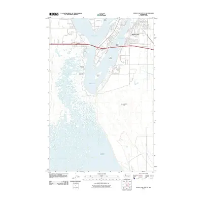
2011 Map of Moses Lake South
USGS Topo · Published 2011About this map
Moses Lake and the smaller settlement of Westlake anchor the northern portion of this landscape, where the town's grid extends toward the complex shorelines of several large islands. The hydrology of the area is defined by massive water management projects, specifically the Moses Lake North Dam and Moses Lake South Dam, which regulate the flow into the extensive Potholes Reservoir to the south. This transition from a developed lakeside community to a more arid, topographical desert environment is most evident in the No-Outlet Sand Hills, a feature-sparse region that contrasts sharply with the residential streets like W Lakeside Dr and Jonathan Rd NE. The map documents the intricate relationship between the desert geography of Grant County and the engineered water systems that sustain the modern community.
Find a feature on this map
94 named features on this map. Tap any name to fly to it.
Don’t see what you’re looking for? This feature index may not catch every label — zoom into the map to look around manually.
Map Details
Editions of this 2011 Moses Lake South Map
This is the sole edition of this map. No revisions or reprints were ever made.
Other maps of this area

1912 · Moses Lake
USGS Topo · 1:62,500

1923 · Corfu
USGS Topo · 1:62,500

1923 · Wheeler
USGS Topo · 1:62,500

1924 · Othello
USGS Topo · 1:62,500

1925 · Wheeler
USGS Topo · 1:62,500

1951 · Corfu
USGS Topo · 1:62,500

1953 · Walla Walla
USGS Topo · 1:250,000

1953 · Ritzville
USGS Topo · 1:250,000

1954 · Soda Lake
USGS Topo · 1:24,000

1954 · Othello
USGS Topo · 1:62,500