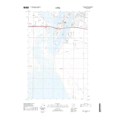
2020 Map of Moses Lake South
USGS Topo · Published 2020About this map
Moses Lake dominates the upper portion of this quadrangle, defining the shoreline and residential patterns as they existed in the early twenty-first century. The intricate network of bays and inlets, including Parker Horn and Pelican Horn, shaped the expansion of the city as it grew southward toward the extensive wetland complex that fills the lower half of the map. In the northwest, the settlement of Mae Valley sits near agricultural corridors like Winesap Rd NE and Jonathan Rd NE, reflecting the region’s long-standing connection to orchard culture.
Find a feature on this map
87 named features on this map. Tap any name to fly to it.
Don’t see what you’re looking for? This feature index may not catch every label — zoom into the map to look around manually.
Map Details
Editions of this 2020 Moses Lake South Map
This is the sole edition of this map. No revisions or reprints were ever made.
Other maps of this area

1912 · Moses Lake
USGS Topo · 1:62,500

1923 · Corfu
USGS Topo · 1:62,500

1923 · Wheeler
USGS Topo · 1:62,500

1924 · Othello
USGS Topo · 1:62,500

1925 · Wheeler
USGS Topo · 1:62,500

1951 · Corfu
USGS Topo · 1:62,500

1953 · Walla Walla
USGS Topo · 1:250,000

1953 · Ritzville
USGS Topo · 1:250,000

1954 · Soda Lake
USGS Topo · 1:24,000

1954 · Othello
USGS Topo · 1:62,500