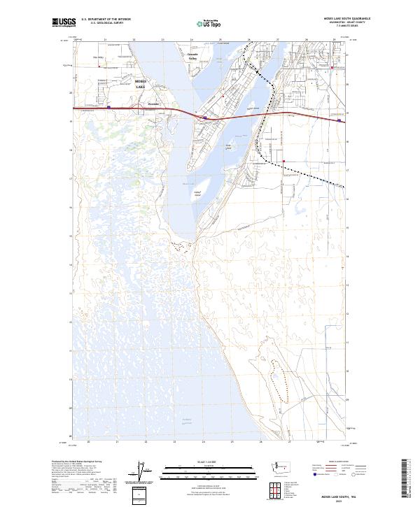
2023 Map of Moses Lake South
USGS Topo · Published 2023About this map
Moses Lake serves as the central focal point of this Grant County landscape, showing the complex interaction of water and settlement as of 2023. Residential expansion is evident in communities like Mae Valley, Cascade Valley, and Westlake, which wrap around the distinctive water arms of Lewis Horn, Parker Horn, and Pelican Horn. The map documents a highly developed shoreline where suburban street grids, such as those near W Broadway Ave and S Division St, meet the irregular edges of the lake.
Find a feature on this map
106 named features on this map. Tap any name to fly to it.
Don’t see what you’re looking for? This feature index may not catch every label — zoom into the map to look around manually.
Map Details
Editions of this 2023 Moses Lake South Map
This is the sole edition of this map. No revisions or reprints were ever made.
Other maps of this area

1912 · Moses Lake
USGS Topo · 1:62,500

1923 · Corfu
USGS Topo · 1:62,500

1923 · Wheeler
USGS Topo · 1:62,500

1924 · Othello
USGS Topo · 1:62,500

1925 · Wheeler
USGS Topo · 1:62,500

1951 · Corfu
USGS Topo · 1:62,500

1953 · Walla Walla
USGS Topo · 1:250,000

1953 · Ritzville
USGS Topo · 1:250,000

1954 · Soda Lake
USGS Topo · 1:24,000

1954 · Othello
USGS Topo · 1:62,500