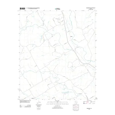
2012 Map of Mosheim
USGS Topo · Published 2012About this map
Mosheim and the small settlement of Pendell anchor this 2012 survey of the rural Bosque County landscape. The area is defined by a dense network of watercourses, including the N Bosque River, Hog Cr, and Neils Cr, which dictate the placement of local roads and farmsteads. Genealogical interest is high here, as the map records several family-named burial sites such as Terrell Cem, Kanz Cem, Barton Cem, and the simply named Olde Cem near the southern boundary.
Find a feature on this map
41 named features on this map. Tap any name to fly to it.
Don’t see what you’re looking for? This feature index may not catch every label — zoom into the map to look around manually.
Map Details
Editions of this 2012 Mosheim Map
This is the sole edition of this map. No revisions or reprints were ever made.
Other maps of this area

1888 · Meridian
USGS Topo · 1:125,000

1892 · Waco
USGS Topo · 1:125,000

1894 · Meridian
USGS Topo · 1:125,000

1920 · Waco
USGS Topo · 1:125,000

1931 · Whitney
USGS Topo · 1:62,500

1931 · Valley Mills
USGS Topo · 1:62,500

1954 · Waco
USGS Topo · 1:250,000

1955 · Waco
USGS Topo · 1:250,000

1955 · Clifton
USGS Topo · 1:24,000
1955 · Turnersville
USGS Topo · 1:24,000