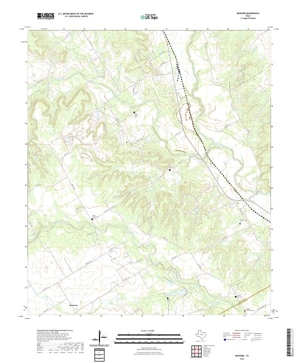
2022 Map of Mosheim
USGS Topo · Published 2022About this map
Mosheim sits at the intersection of rural life and the winding waterways of the Texas prairie, where the drainage of Hog Creek and Shoal Cr carves through the landscape. This map captures the intricate boundary where Bosque Co meets McLennan Co, a region defined by scattered family farmsteads and a deep connection to the land. The presence of several family-named burial sites, including the Terrell Family Cem and the Scrutchfield Cem, highlights the long-standing genealogical roots of the area's inhabitants.
Find a feature on this map
48 named features on this map. Tap any name to fly to it.
Don’t see what you’re looking for? This feature index may not catch every label — zoom into the map to look around manually.
Map Details
Editions of this 2022 Mosheim Map
This is the sole edition of this map. No revisions or reprints were ever made.
Other maps of this area

1888 · Meridian
USGS Topo · 1:125,000

1892 · Waco
USGS Topo · 1:125,000

1894 · Meridian
USGS Topo · 1:125,000

1920 · Waco
USGS Topo · 1:125,000

1931 · Whitney
USGS Topo · 1:62,500

1931 · Valley Mills
USGS Topo · 1:62,500

1954 · Waco
USGS Topo · 1:250,000

1955 · Waco
USGS Topo · 1:250,000

1955 · Clifton
USGS Topo · 1:24,000
1955 · Turnersville
USGS Topo · 1:24,000