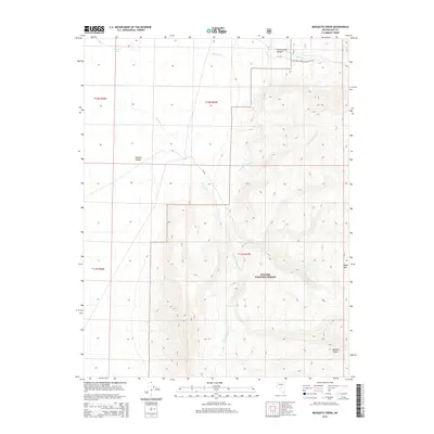
2014 Map of Mosquito Creek
USGS Topo · Published 2014About this map
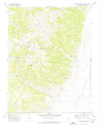
Toiyabe National Forest dominates this section of the high desert, where the steep eastern slopes of the Monitor Range meet the broad floor of Monitor Valley. This 2014 survey documents the complex drainage system of Mosquito Creek and its major tributaries, including North Fork Mosquito Creek and South Fork Mosquito Creek, which carve deep canyons through the high-altitude terrain. The topography rises sharply toward the east, reaching features like Table Mountain and Cottonwood Canyon. Historically significant for its inclusion of the National Forest Development Road 142, the map illustrates the infrastructure used to manage these public lands. Further north, the landscape includes Morgan Creek and the localized basin known as Johnson Hole, providing a detailed look at the water sources and land divisions within Nye County.
Find a feature on this map
18 named features on this map. Tap any name to fly to it.
Don’t see what you’re looking for? This feature index may not catch every label — zoom into the map to look around manually.
Map Details
Editions of this 2014 Mosquito Creek Map
This is the sole edition of this map. No revisions or reprints were ever made.
Other maps of this area

1956 · Tonopah
USGS Topo · 1:250,000

1959 · Tonopah
USGS Topo · 1:250,000

1962 · Tonopah
USGS Topo · 1:250,000

1971 · Corcoran Canyon
USGS Topo · 1:24,000

1971 · Barley Creek
USGS Topo · 1:24,000

1971 · Mosquito Creek
USGS Topo · 1:24,000
1971 · Green Monster Canyon
USGS Topo · 1:24,000
1971 · Dobbin Summit
USGS Topo · 1:24,000
1971 · Box Spring
USGS Topo · 1:24,000
1971 · Northumberland Pass
USGS Topo · 1:24,000