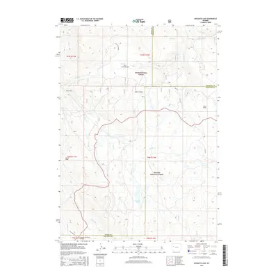
2015 Map of Mosquito Lake
USGS Topo · Published 2015About this map
The Bridger National Forest and Teton National Forest meet in this high-altitude landscape, defining a remote wilderness where Teton, Fremont, and Sublette counties converge. The terrain is characterized by significant natural drainages such as Bacon Cr and Wagon Cr, which flow through expansive openings like Buffalo Meadow and Park Creek Meadow. This 2015 survey reveals a land primarily managed for its natural resources and wildlife habitat, with the Kinky Creek Divide Airport providing a rare point of aviation access in the southern portion of the quadrangle near Kinky Creek Rd. High-elevation features like Bacon Ridge and Piñon Ridge separate the various watersheds, while Mosquito Lake serves as a prominent water body in the central basin. The map illustrates the complex boundary lines of three Wyoming counties intersecting amidst the ridgelines and creeks.
Find a feature on this map
34 named features on this map. Tap any name to fly to it.
Don’t see what you’re looking for? This feature index may not catch every label — zoom into the map to look around manually.
Map Details
Editions of this 2015 Mosquito Lake Map
This is the sole edition of this map. No revisions or reprints were ever made.
Other maps of this area

1902 · Mt Leidy
USGS Topo · 1:125,000

1905 · Younts Peak
USGS Topo · 1:125,000

1907 · Younts Peak
USGS Topo · 1:125,000

1907 · Gros Ventre
USGS Topo · 1:125,000

1909 · Fremont Peak
USGS Topo · 1:125,000

1910 · Gros Ventre
USGS Topo · 1:125,000

1955 · Driggs
USGS Topo · 1:250,000

1955 · Thermopolis
USGS Topo · 1:250,000

1956 · Fish Lake
USGS Topo · 1:24,000

1958 · Driggs
USGS Topo · 1:250,000