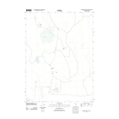
2011 Map of Mosquito Valley
USGS Topo · Published 2011About this map
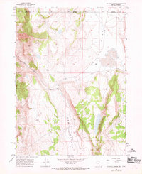
Mosquito Valley defines the landscape of this high-desert Washoe County survey, characterized by a sparse network of ranching outposts and vital water sources. The map reveals the vital reliance on isolated springs and reservoirs, including Gravelly Spring and Hill Reservoir, which support the scattered habitations of the region. A series of family-named ranches, such as Steward Ranch, Drown Ranch, and Morris Ranch, are linked by the winding paths of Fort Bidwell Rd and Cow Camp Rd. The presence of Mosquito Lake and Berrey Brook further illustrates the hydrology of this basin-and-range environment. This 2011 record preserves the footprint of a remote ranching economy, showing the precise locations of residences like Knoll Ranch and Parry Ranch before the shift of the modern era.
Find a feature on this map
16 named features on this map. Tap any name to fly to it.
Don’t see what you’re looking for? This feature index may not catch every label — zoom into the map to look around manually.
Map Details
Editions of this 2011 Mosquito Valley Map
This is the sole edition of this map. No revisions or reprints were ever made.
Other maps of this area

1889 · Long Valley
USGS Topo · 1:250,000

1954 · Vya
USGS Topo · 1:250,000

1958 · Vya
USGS Topo · 1:250,000

1962 · Vya
USGS Topo · 1:250,000
1966 · Barrel Springs
USGS Topo · 1:24,000

1966 · Massacre Lake NW
USGS Topo · 1:24,000
1966 · Mosquito Valley
USGS Topo · 1:24,000
1966 · Little Coleman Canyon
USGS Topo · 1:24,000
1966 · Coleman Canyon
USGS Topo · 1:24,000
1966 · Calcutta Lake
USGS Topo · 1:24,000