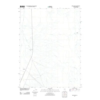
2011 Map of Moss Creek
USGS Topo · Published 2011About this map
Hot Springs Ranch and the Valley of the Moon Ranch anchor the western edge of this basin landscape, where the seasonal waters of the Reese River flow northward. This area of Lander County is defined by a sparse network of ranching outposts and drainage systems typical of the high desert. The map traces the winding paths of Moss Creek and Cottonwood Creek as they descend from the higher terrain toward the valley floor. Near the eastern boundary, Smith Flat provides a distinctive level landscape amidst the surrounding foothills. Critical water sources for local livestock and wildlife are identified at Cottonwood Spring and Lake Spring, which likely served as focal points for land use and early settlement in this arid region of Nevada.
Find a feature on this map
8 named features on this map. Tap any name to fly to it.
Don’t see what you’re looking for? This feature index may not catch every label — zoom into the map to look around manually.
Map Details
Editions of this 2011 Moss Creek Map
This is the sole edition of this map. No revisions or reprints were ever made.
Other maps of this area

1932 · Sonoma Range
USGS Topo · 1:250,000

1939 · Sonoma Range
USGS Topo · 1:250,000

1949 · Mt. Lewis
USGS Topo · 1:62,500

1950 · Mt. Lewis
USGS Topo · 1:62,500

1955 · Winnemucca
USGS Topo · 1:250,000

1958 · Winnemucca
USGS Topo · 1:250,000

1961 · McCoy
USGS Topo · 1:62,500

1961 · The Cedars
USGS Topo · 1:62,500

1962 · Winnemucca
USGS Topo · 1:250,000

1962 · Carico Lake
USGS Topo · 1:62,500