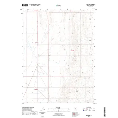
2018 Map of Moss Creek
USGS Topo · Published 2018About this map
Reese River flows through the western lowlands of this high-desert landscape in Lander County, marking a stark contrast to the elevation of the Shoshone Range in the southeast. This 2018 survey by the U.S. Geological Survey details a sparsely settled region defined by the drainage patterns of Moss Cr and Cottonwood Cr. These seasonal watercourses cut through the terrain toward the basin, with the high-altitude Smith Flat sitting east of the canyon walls. Local hydrology is further marked by the presence of Lake Spring and Cottonwood Spring, critical water sources in this arid environment. In the northeast corner, the steep topography of Redrock Canyon provides a dramatic geographical landmark. Aside from Fish Creek Rd in the southwest, the area is largely defined by its natural features and the systematic division of public lands into townships and ranges.
Find a feature on this map
15 named features on this map. Tap any name to fly to it.
Don’t see what you’re looking for? This feature index may not catch every label — zoom into the map to look around manually.
Map Details
Editions of this 2018 Moss Creek Map
This is the sole edition of this map. No revisions or reprints were ever made.
Other maps of this area

1932 · Sonoma Range
USGS Topo · 1:250,000

1939 · Sonoma Range
USGS Topo · 1:250,000

1949 · Mt. Lewis
USGS Topo · 1:62,500

1950 · Mt. Lewis
USGS Topo · 1:62,500

1955 · Winnemucca
USGS Topo · 1:250,000

1958 · Winnemucca
USGS Topo · 1:250,000

1961 · McCoy
USGS Topo · 1:62,500

1961 · The Cedars
USGS Topo · 1:62,500

1962 · Winnemucca
USGS Topo · 1:250,000

1962 · Carico Lake
USGS Topo · 1:62,500