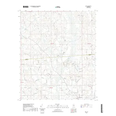
2018 Map of Moss
USGS Topo · Published 2018About this map
Moss sits at the geographical heart of this Pine Belt landscape, where the rural topography is defined by the winding course of Tallahala Cr and its numerous tributaries. The map documents a classic South Mississippi settlement pattern of small, dispersed communities like Shady Grove and Hoy connected by a web of county roads. For genealogists, the map is particularly rich with small burial grounds, including the Union Seminary Cem and the County Line Cem, which often represent the only remaining markers of nineteenth-century church congregations and social centers. The presence of Welborn Cem and Graham Cem further suggests deep-rooted family ties to these hills. The drainage network, featuring named branches such as Billy Hill Reedy Cr and Cypress Creek, illustrates the creek-bottom environment that shaped the local timber and agricultural economy of Jasper and Jones counties.
Find a feature on this map
107 named features on this map. Tap any name to fly to it.
Don’t see what you’re looking for? This feature index may not catch every label — zoom into the map to look around manually.
Map Details
Editions of this 2018 Moss Map
This is the sole edition of this map. No revisions or reprints were ever made.
Other maps of this area

1953 · Hattiesburg
USGS Topo · 1:250,000

1958 · Hattiesburg
USGS Topo · 1:250,000

1963 · Waldrup
USGS Topo · 1:24,000

1964 · Moss
USGS Topo · 1:24,000

1964 · Sandersville
USGS Topo · 1:24,000

1964 · Laurel East
USGS Topo · 1:24,000

1964 · Laurel West
USGS Topo · 1:24,000

1964 · Lake Como
USGS Topo · 1:24,000

1965 · Hebron
USGS Topo · 1:24,000

1974 · Soso
USGS Topo · 1:24,000