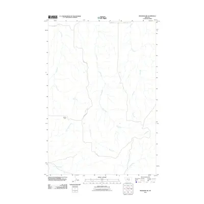
2011 Map of Mossmain SW
USGS Topo · Published 2011About this map
The Mosser Dome Oil Field defines the industrial footprint of this Yellowstone County landscape, where the extraction economy meets a network of drainage basins. The area is characterized by the convergence of several significant waterways, including the winding paths of Davis Creek and Duck Creek, which carve through the terrain alongside Spring Creek and Little Cottonwood Creek. These watercourses dictate the local geography and the placement of rural infrastructure.
Find a feature on this map
11 named features on this map. Tap any name to fly to it.
Don’t see what you’re looking for? This feature index may not catch every label — zoom into the map to look around manually.
Map Details
Editions of this 2011 Mossmain SW Map
This is the sole edition of this map. No revisions or reprints were ever made.
Other maps of this area

1954 · Billings
USGS Topo · 1:250,000

1956 · Silesia
USGS Topo · 1:24,000

1956 · Laurel
USGS Topo · 1:24,000

1956 · Edgar
USGS Topo · 1:24,000

1956 · Yegen
USGS Topo · 1:24,000

1956 · Mossmain
USGS Topo · 1:24,000

1957 · Billings
USGS Topo · 1:250,000

1958 · Billings
USGS Topo · 1:250,000

1967 · Pryor
USGS Topo · 1:24,000
1967 · Mossmain SW
USGS Topo · 1:24,000