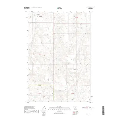
2020 Map of Mossmain SW
USGS Topo · Published 2020About this map
The county line between Yellowstone Co and Carbon Co divides this landscape, where the high plains are carved by a dense network of drainage systems. The topography is defined by the descent into the Cottonwood Creek and Little Cottonwood Creek basins, which dominate the southern half of the sheet. Modern transport follows the ancient lines of the land, with routes like Silesia Rd and Cottonwood Creek Rd skirting the breaks. To the north, the terrain transitions into a series of ridges and draws associated with Davis Creek and Spring Creek. The placement of Moser Dome Rd and Price Hill Rd suggests the continued importance of access to these higher elevations and their associated watersheds, including Duck Creek and Buck Creek to the east.
Find a feature on this map
22 named features on this map. Tap any name to fly to it.
Don’t see what you’re looking for? This feature index may not catch every label — zoom into the map to look around manually.
Map Details
Editions of this 2020 Mossmain SW Map
This is the sole edition of this map. No revisions or reprints were ever made.
Other maps of this area

1954 · Billings
USGS Topo · 1:250,000

1956 · Silesia
USGS Topo · 1:24,000

1956 · Laurel
USGS Topo · 1:24,000

1956 · Edgar
USGS Topo · 1:24,000

1956 · Yegen
USGS Topo · 1:24,000

1956 · Mossmain
USGS Topo · 1:24,000

1957 · Billings
USGS Topo · 1:250,000

1958 · Billings
USGS Topo · 1:250,000

1967 · Pryor
USGS Topo · 1:24,000
1967 · Mossmain SW
USGS Topo · 1:24,000