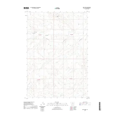
2020 Map of Mott Creek
USGS Topo · Published 2020About this map
Wild Horse Ridge dominates the northern skyline of this Big Horn County landscape, where the high ground transitions into a complex system of drainages and coulees. The terrain is defined by the carved paths of Beauvais Cr and Mott Cr, which structure the movement of both water and local travel through the region. This 2020 survey illustrates a sparsely settled area where transportation is anchored by the Pryor-St Xavier Hwy and the connected Pryor St X Rd. The map reveals the intricate natural topography of the Crow Reservation vicinity, naming several distinctive landforms such as Corral Coulee, Bear Coulee, and Horse Coulee. These features indicate a history of land use tied closely to the natural contours of the Montana plains, where named points like Point Cr and Muddy Cr served as essential landmarks for navigation and ranching.
Find a feature on this map
14 named features on this map. Tap any name to fly to it.
Don’t see what you’re looking for? This feature index may not catch every label — zoom into the map to look around manually.
Map Details
Editions of this 2020 Mott Creek Map
This is the sole edition of this map. No revisions or reprints were ever made.
Other maps of this area

1893 · Huntley
USGS Topo · 1:125,000

1894 · St. Xavier
USGS Topo · 1:125,000

1894 · Fort Custer
USGS Topo · 1:125,000

1901 · St. Xavier
USGS Topo · 1:125,000

1915 · Spenceville
USGS Topo · 1:31,680

1954 · Billings
USGS Topo · 1:250,000

1954 · Hardin
USGS Topo · 1:250,000

1957 · Hardin
USGS Topo · 1:250,000

1957 · Billings
USGS Topo · 1:250,000

1958 · Billings
USGS Topo · 1:250,000