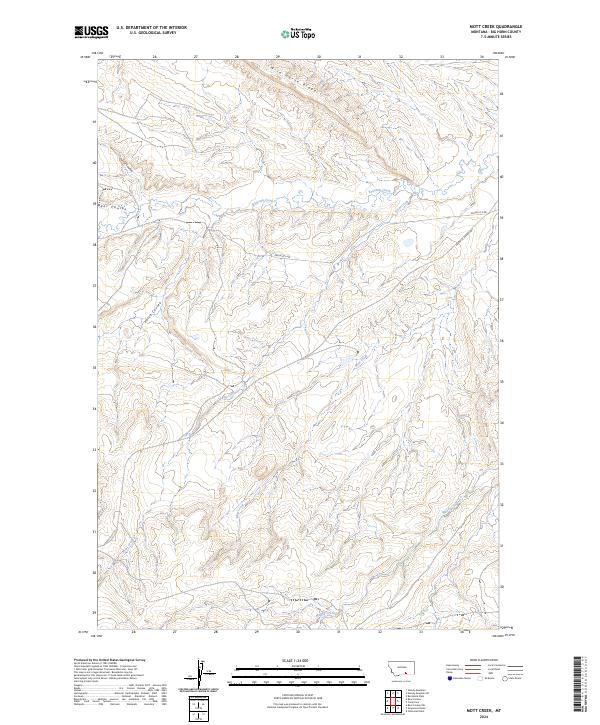
2024 Map of Mott Creek
USGS Topo · Published 2024About this map
Wild Horse Ridge dominates the northern landscape of this Big Horn County territory, overseeing a complex network of coulees and drainages. The area is defined by the high-relief terrain of the Crow Reservation, where deep-cut watercourses like Beauvais Creek and Mott Creek carve through the sedimentary layers. This modern survey illustrates the persistent rural character of the region, where infrastructure is limited to essential connectors like the Pryor-St Xavier Hwy and Pryor-St X Rd. The transition between the high ridges and the valley floors of Muddy Creek and Point Creek highlights the drainage patterns that have historically dictated movement and land use across these townships.
Find a feature on this map
14 named features on this map. Tap any name to fly to it.
Don’t see what you’re looking for? This feature index may not catch every label — zoom into the map to look around manually.
Map Details
Editions of this 2024 Mott Creek Map
This is the sole edition of this map. No revisions or reprints were ever made.
Other maps of this area

1893 · Huntley
USGS Topo · 1:125,000

1894 · St. Xavier
USGS Topo · 1:125,000

1894 · Fort Custer
USGS Topo · 1:125,000

1901 · St. Xavier
USGS Topo · 1:125,000

1915 · Spenceville
USGS Topo · 1:31,680

1954 · Billings
USGS Topo · 1:250,000

1954 · Hardin
USGS Topo · 1:250,000

1957 · Hardin
USGS Topo · 1:250,000

1957 · Billings
USGS Topo · 1:250,000

1958 · Billings
USGS Topo · 1:250,000