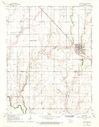
1965 Map of Moundridge
USGS Topo · Published 1966About this map
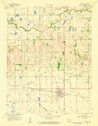
Moundridge serves as the central hub of this mid-1960s Kansas landscape, situated at the intersection of the Missouri Pacific railroad and local thoroughfares. The town exhibits a clear grid pattern, including a water tank and a Memorial Home for the Aged at its eastern edge. Beyond the town limits, the agricultural character of McPherson and Harvey Counties is evident through a network of section lines and rural institutions.
Find a feature on this map
25 named features on this map. Tap any name to fly to it.
Don’t see what you’re looking for? This feature index may not catch every label — zoom into the map to look around manually.
Map Details
Editions of this 1965 Moundridge Map
2 editions found
Other maps of this area

1889 · Newton
USGS Topo · 1:125,000

1891 · Hutchinson
USGS Topo · 1:125,000

1893 · Hutchinson
USGS Topo · 1:125,000

1894 · Newton
USGS Topo · 1:125,000

1955 · Hutchinson
USGS Topo · 1:250,000

1959 · Hutchinson
USGS Topo · 1:250,000
1959 · Zimmerdale
USGS Topo · 1:24,000
1959 · Halstead
USGS Topo · 1:24,000
1959 · Burrton
USGS Topo · 1:24,000

1965 · Mc Pherson South
USGS Topo · 1:24,000